The Philip Goldson Highway is one of the three major thoroughfares in Belize. Connecting Belize City to points north, including Orange Walk District and Orange Walk Town all the way to the Mexican border, the Philip Goldson Highway is 95 miles (153) kilometers long. The Philip Goldson Highway is completely paved and is a two-lane roadway for most of its length.
Formerly known as the Northern Highway, the roadway was renamed in 2012, although many locals continue to refer to it by its old name. The highway is named after Philip Stanley Wilberforce Goldson, a Belizean newspaper editor, politician, and activist. Belize City’s international airport is also named for Philip Goldson, and the Philip Goldson Highway passes by the airport.
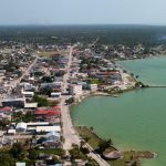
Starting in Belize City, key points along the Philip Goldson Highway include the exit for the village of Burrell Boom (mile marker 12.4), the access road to the ancient Maya site of Altun Ha (mile marker 17.5), the village of Crooked Tree (mile marker 29.7), Orange Walk Town (mile marker 52), the access road to Corozal Town (mile marker 78.8), the bridge over the Hondo River (mile marker 87), ending at the border crossing into the Mexican town of Chetumal City in Quintana Roo State.
Featured Belize Resort
Advertisment

Featured Tour Company
Advertisment

Real Estate Opportunities
Advertisment

Comments
Advertisment

Advertisment
Advertisment